1 / 5
| Model NO. | WGMD |
| Vertical Lines | IP Survey Equipment |
| Max. Power Supply Voltage | 1500V |
| Max. Power Supply Current | 6A |
| Electrical Prospecting | Vertical Electrical Sounding, Electrical Profiling |
| Application | Hydrology, Geophysical Exploration, Metal, Water |
| Measuring Way | Resistivity/IP Sounding, Tomography |
| Usage | 2D Resistivity/IP Tomography |
| Electrode Array | Wenner, Schlumberger, Dipole-Dipole, etc. |
| Detection Depth | 500m for Vertical Sounding, 300m for 2D Tomography |
| Electrode Options | 60 Electrode / 120 Electrode |
| Cable Spacing | 3m, 5m, 10m Optional |
| Weight | 4kg (Portable and Small) |
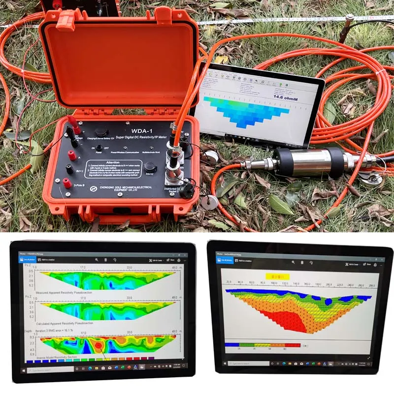
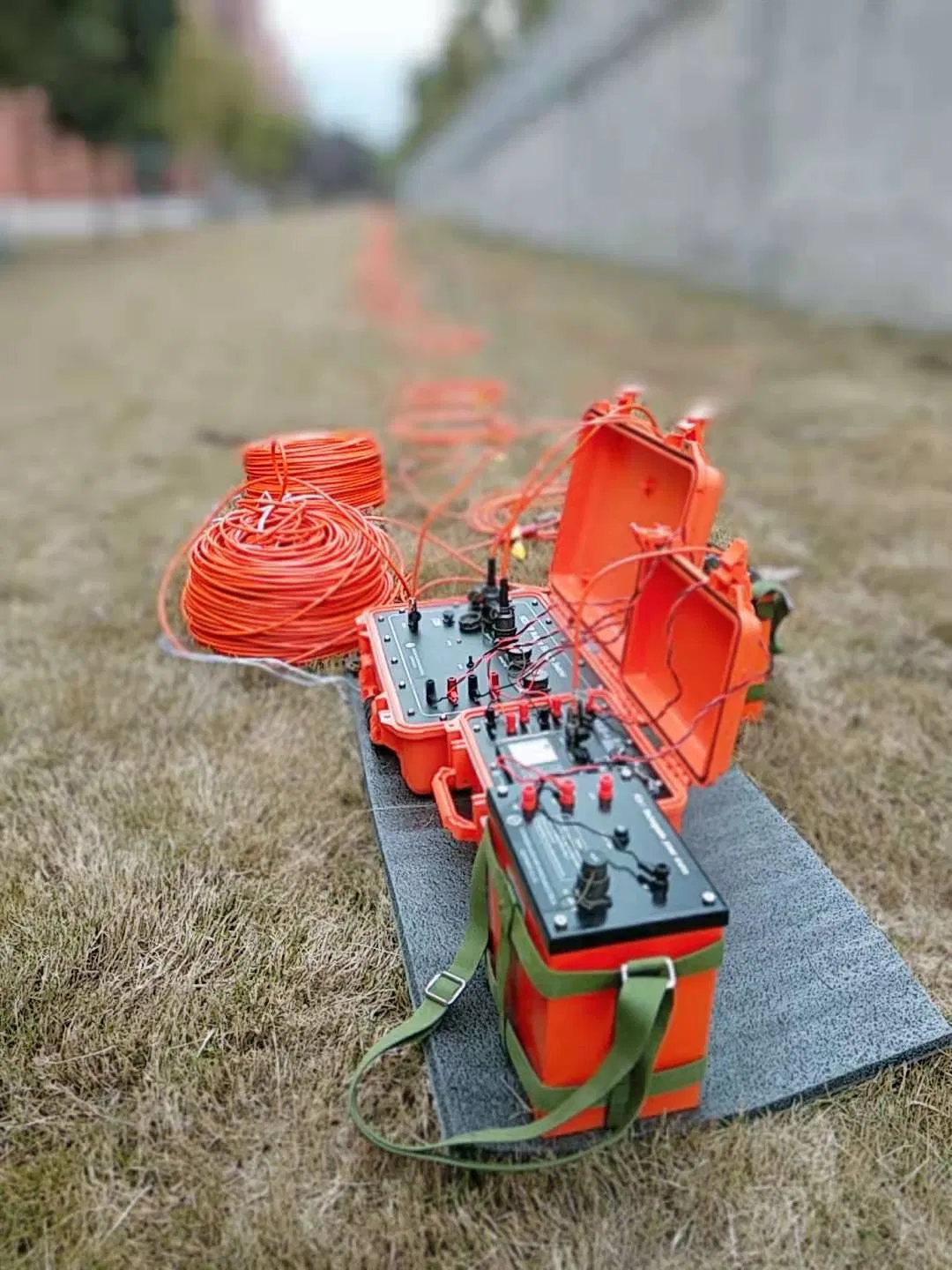
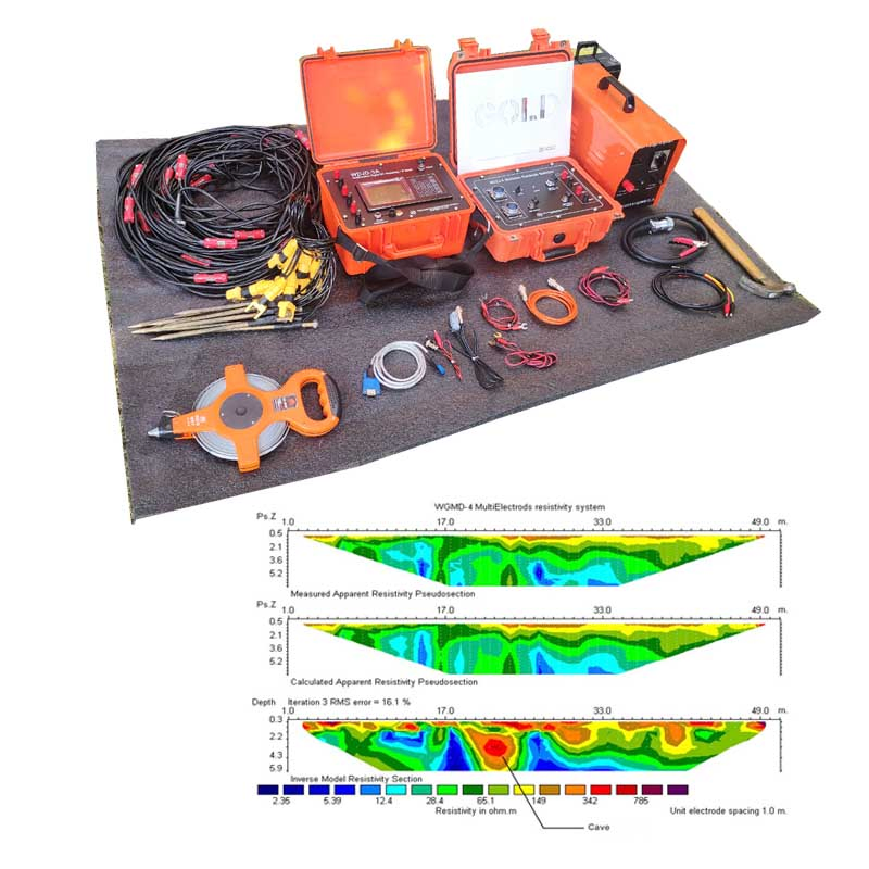
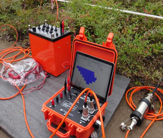
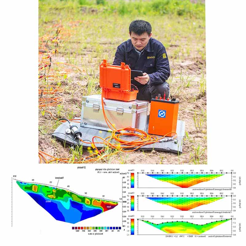
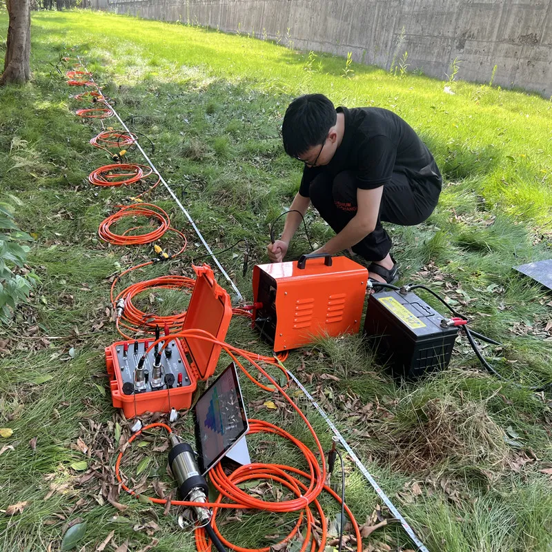
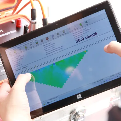
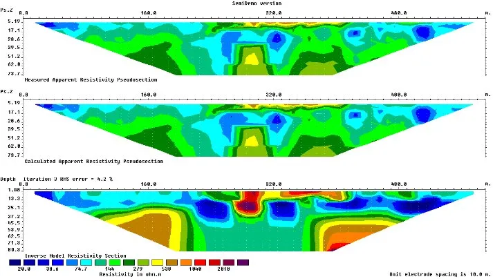
Electrical Resistivity Tomography (ERT) imaging equipment is a sophisticated geophysical technique used for subsurface imaging and exploration. It operates by measuring the electrical resistivity of the ground or structures to create detailed images depicting variations in subsurface properties. This non-destructive method is widely utilized in geotechnical investigations, environmental studies, and civil engineering.
Provides detailed insights into geological formations and buried objects through high-resolution subsurface mapping.
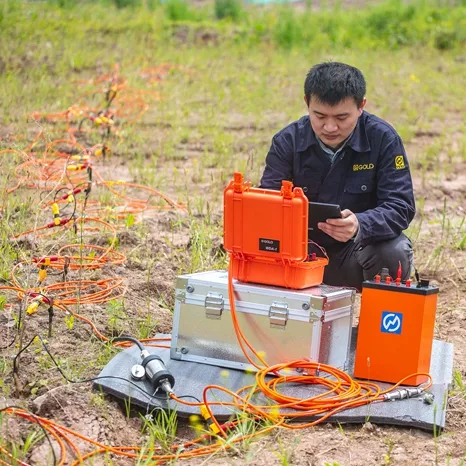
Allows exploration without disrupting the ground or existing structures, making it highly cost-effective.
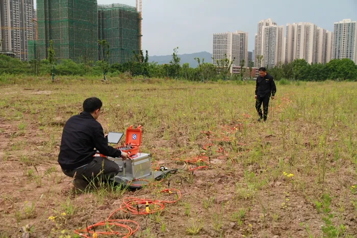
Adaptable to various terrains, from dense urban settings to remote field locations.
Enables rapid data collection across large areas for efficient field investigation and decision-making.
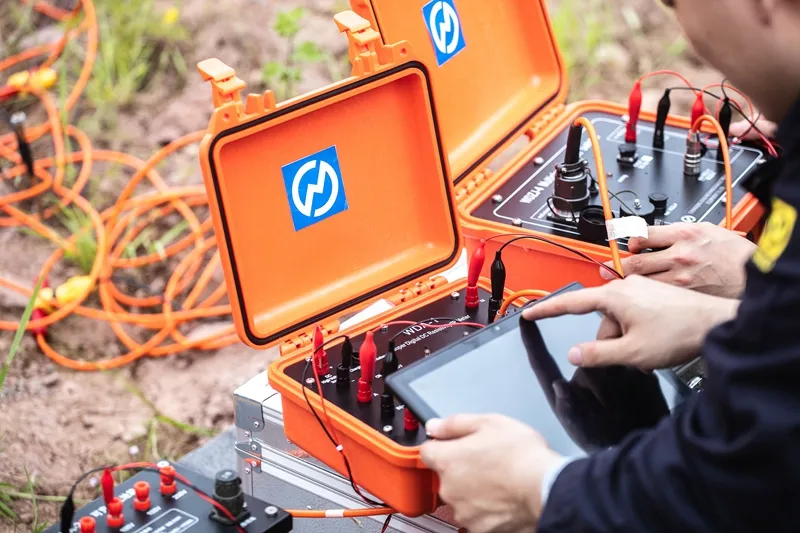
| Transmitting Parameters | |
|---|---|
| Maximum Power | 9000W (VES), 2400W (Imaging) |
| Maximum Voltage | 1500V (VES), 800V (Imaging) |
| Maximum Current | 6A (VES), 3A (Imaging) |
| Pulse Width | 1~60s, duty cycle 1:1 |
| Receiving Parameters | |
| Voltage Input | ± 80V (24 bit A/D) |
| Vp Accuracy | ±0.2% ±1LSB (if Vp≥5mV) |
| Current Input | 6A (24 bit A/D) |
| Input Impedance | >100 MΩ |
| Suppression | ≥80dB (for 50Hz/60Hz interference) |